Maps
CB6 Speed Limits
CB6 Parks, Pools & Recreation Map
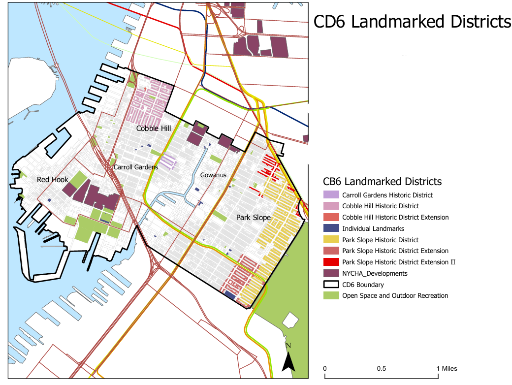
Landmarks Map
Find individual landmarks and historic districts here
NYC Bathroom Map
Public restrooms are woefully lacking in New York City. There are only roughly 1,100 public toilets for 8.6 million residents – meaning only one for every 6,000 New Yorkers. We rank 93rd out of the 100 largest U.S. cities in public bathrooms per capita.
This New York City Public Bathrooms Map is a resource for public restrooms furnished by the City. This map indicates 11 public restrooms currently exist in CB6, nine in parks and playgrounds (82%), two in libraries (18%).

Meanwhile, the Got2GoNYC crowdsourced map provides locations of public restrooms near you in addition to accessible bathrooms furnished by private businesses. Manhattan BP Levine has used this map to craft policies with the Mayor to open government building restrooms to the public and to build more bathrooms. CB6 Councilmembers Shahana Hanif (District 39) and Alexa Aviles (District 38) have co-sponsored two bills to open restrooms in public institutions to the public, and to create a long-term strategy in the City Office of the Public Realm to provide more public restrooms.
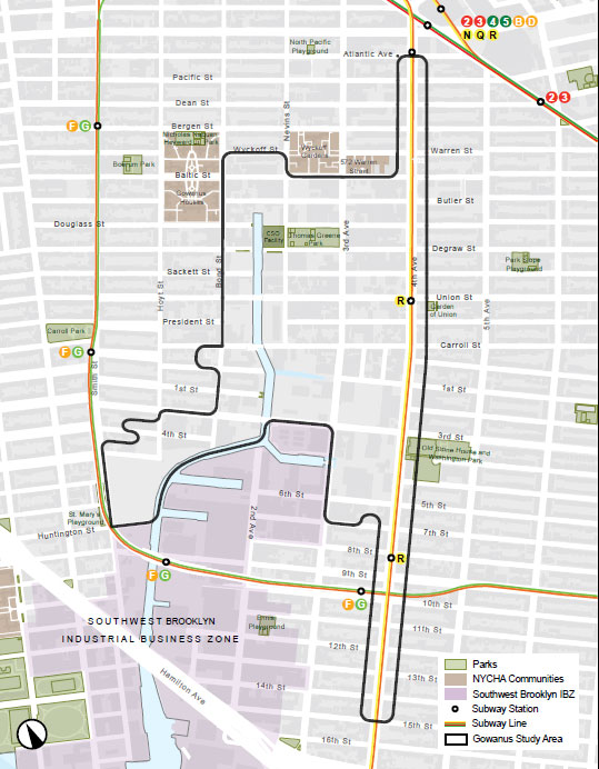
Gowanus Neighborhood Rezoning Map
Along with DCP’s phenomenal Rezoning Commitments Tracker, the Gowanus Oversight Task Force has listed and mapped the Points of Agreement (POA) with the City of New York to ensure that commitments are met in a timely and equitable manner. Below is the simple Area Map from DCP.